
Walk a Marion County Street
Begin with one valid property address, not a person's name. Marion County records use three address concepts. The situs address is the parcel's physical place. The mailing address is where the tax contact receives notices and may point outside Indiana. The legal description identifies the lot, block, subdivision, or metes-and-bounds tract. That description can stay stable through a change in house number. A street directory search should keep all three fields separate.
The official assessor and MapIndy tools establish the modern parcel first. Recorded deeds then identify parties tied to title, while voter and directory sources supply narrower evidence about registered or historical residents. This order avoids turning a tax mailing address into a claim about who sleeps at the property.
- Enter the exact address in the Marion County Assessor Property Report Cards search and select its autocomplete suggestion.
- Save the county parcel number, state parcel number, situs address, legal description, owner, and separate mailing address.
- Open MapIndy, select the parcel, and inspect each neighboring polygon rather than assuming one query exports the whole street.
- Use the owner and legal description in the recorder index. Follow each deed party backward, recording the instrument date and role.
- Check lawful voter channels and the library's historical directories for evidence tied to a date, never as a complete household list.
Repeat those steps for each street number in the chosen block. Condominiums, split parcels, and merged lots may need separate cards. A useful Marion County by-address worksheet gives every assertion a record name and date.
Search Marion County Addresses
The Marion County Assessor Property Report Cards portal offers four search modes. Address mode uses autocomplete, so choose the displayed match instead of merely typing a line and stopping. Owner search accepts all or part of a name. Parcel identifiers are better when two addresses look alike or a street suffix has changed.
| Search control | Input | Use in a street directory |
|---|---|---|
| Parcel Number | Seven digits | Returns the county parcel without relying on spelling. |
| State Parcel Number | 18 digits, plain or formatted | Provides the statewide parcel key beginning with 49. |
| Owner Name | All or part of name | Checks other cards associated with the indexed owner. |
| Address | Text with autocomplete | Finds one property address and its card. |
A card may show township, district, plat, map, book and page, legal description, transfer rows, values, land data, and site traits. The transfer table has date, grantor, validity, amount, and type fields. It still does not provide a resident roster.
The assessor search screen is shown below. Its separate modes make the first link in the address-to-parcel chain clear.
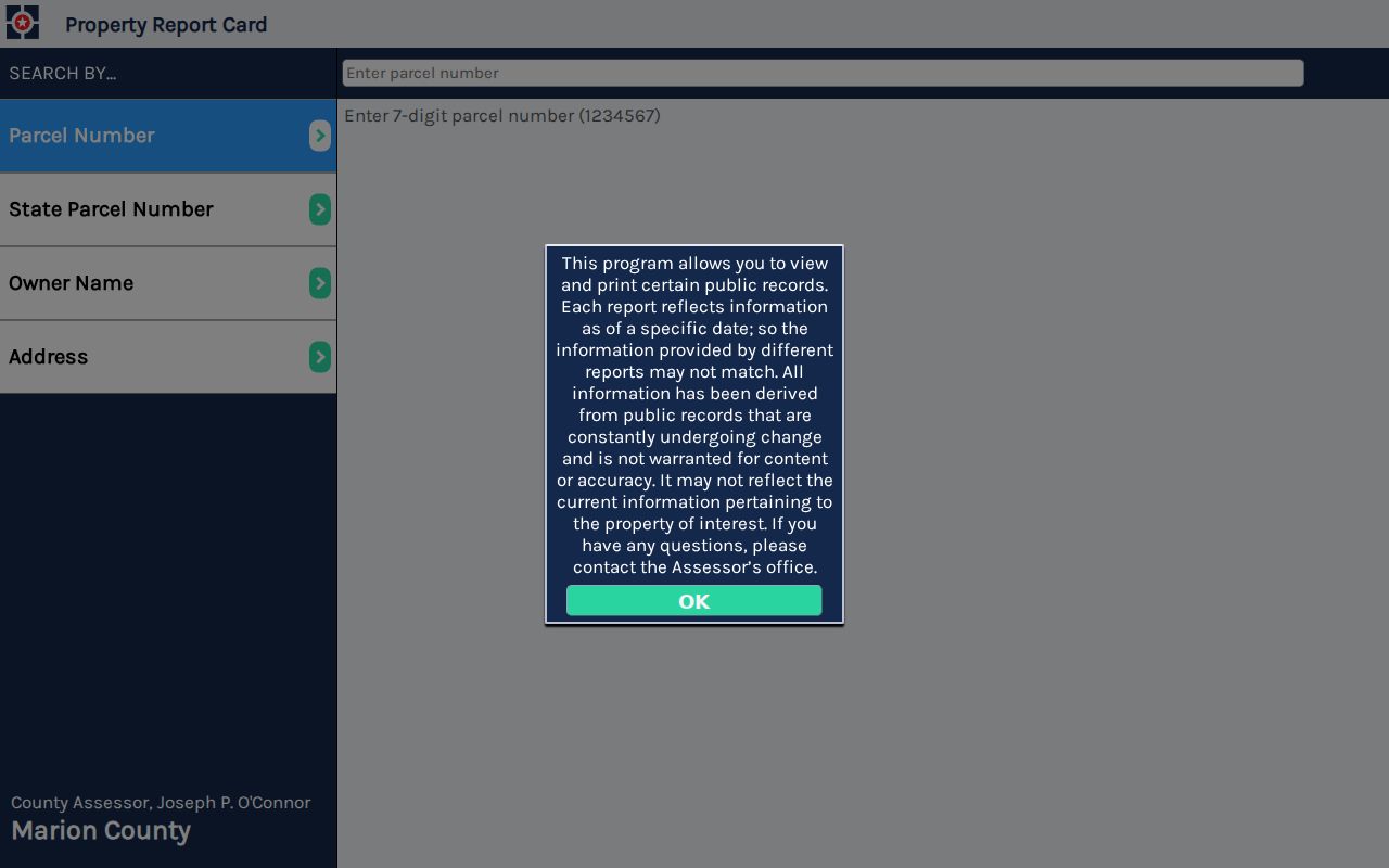
Selecting the correct suggestion leads to the parcel facts needed for later map and deed work.
Map Marion County Street Parcels
MapIndy supplies the spatial view that the assessor's one-record search lacks. Search an address or parcel, turn on parcel and unit-address layers, and inspect the shapes along the block. Street labels, ZIP codes, townships, excluded cities, registered organizations, zoning, subdivisions, and districts add context. These layers describe geography, not a household.
The MapIndy help screen documents search, selection, measurement, drawing, historic basemaps, and printing.
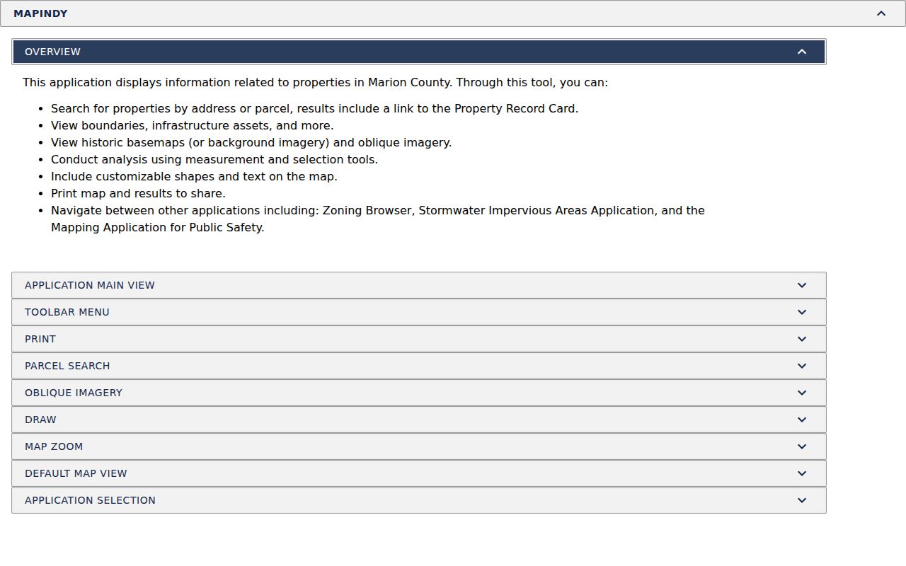
Selection and print tools make it practical to save a defined street segment before opening cards one parcel at a time.
The live MapIndy parcel viewer is also captured below.

Adjacent parcel outlines help expose skipped numbers, corner lots, and lots whose mailing address points elsewhere.
Note: MapIndy limits service queries and should not be treated as certified title or proof of residence.
Marion County By-Street Records
Each Marion County street directory source answers a different question. The assessor names the indexed owner and parcel facts. GIS places the parcel. The recorder connects parties to filed instruments. Permits name applicants or projects. Voter records cover registered voters under Indiana access rules. Historical publications associate a name or business with an address in a stated year.
| Record Set | Keeper | What It Shows | Access |
|---|---|---|---|
| Property card | Marion County Assessor | Owner, situs and mailing addresses, legal description, transfers | Free online search |
| GIS parcel map | Indianapolis GIS | Parcel shapes, address points, ZIP, township, and district layers | Free MapIndy viewer |
| Recorded instruments | Marion County Recorder | Parties, document type, date, legal description | Fidlar index, office terminal, counter |
| Voter information | Indiana and Marion elections offices | Registration evidence subject to protected-record rules | Individual portal or lawful list request |
| Permit cases | Indianapolis Accela | Case, project, applicant, street range, parcel, and dates | Public general search |
| Historical directories | IU Indianapolis, IndyPL, State Library | Dated resident or business associations with addresses | Digital scans, library, microfilm |
The chain works because one source supplies the key needed by the next. A street address yields a parcel; its card yields an owner and legal description; those terms unlock the deed index. A deed or permit date then points to the nearest directory year. Keep conflicts. They may show a mailing contact, a recent sale, or a lag between publication and a move.
Link Marion County Deed Parties
The Marion County Recorder Fidlar index does not offer an address or parcel mode in the inspected public settings. Search by exact indexed party name, date range, document type, document number, or subdivision lot and block. Wildcards are not enabled. Results may show document type, recorded date, Party1, Party2, and legal text, but those columns do not promise that each party is an owner.
The recorder search interface illustrates why the assessor must usually come first.
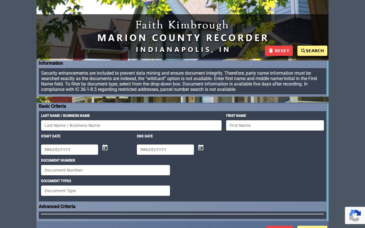
Its name and document filters turn a parcel-card owner into a deed-chain search, not an address sweep.
The recorder's historical guide covers records from 1821 through March 31, 1964. Records from 1950 through that cutoff use an A plus year and instrument format. Earlier work uses two-letter book codes such as DE for deed, MG for mortgage, and LN for lien, followed by book and page. Search the seller from one deed as a party in an earlier filing, and verify the legal description at every link.
- Parcel
- A mapped unit of land with county and state identifiers.
- Situs address
- The physical address of the parcel, distinct from the tax mailing address.
- Plat
- A recorded map that divides land into lots, blocks, streets, or easements.
- Criss-cross directory
- A directory arranged by street or telephone number rather than only by surname.
Inspect Marion County Permit Addresses
The public Indianapolis Accela permit search accepts a street-number range, direction, street name, street type, unit, parcel number, case number, project name, date range, person, business, and license fields. That makes it one of the few Marion County tools suited to a bounded by-street query. An applicant can be a contractor, agent, or business, so a name in a case is not proof of ownership or occupancy.
The Accela search page shows the street-range and parcel controls available for permit research.
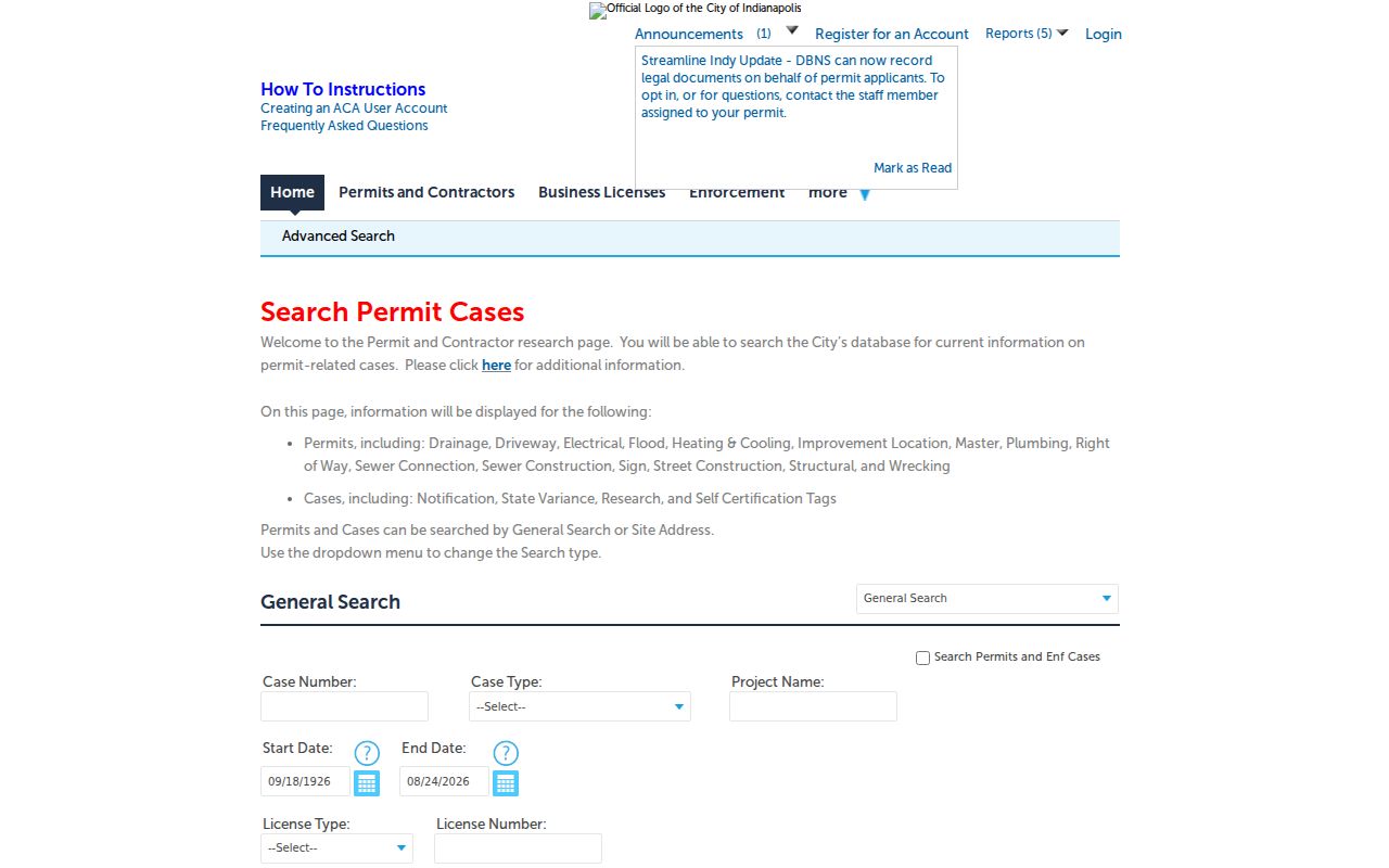
Use the resulting case number and project date to request or inspect the underlying case when the public summary is thin.
Plats and recorded instruments belong with the recorder, while planning and historic-preservation cases may sit in Accela. If a portal omits a public document, contact the responsible office with the exact address, parcel, case number, and date. Indiana APRA permits oral or written requests for existing inspectable records; it does not require a custodian to create a new street roster.
Decode Marion County Street Changes
Indianapolis uses Washington Street as the north-south numbering base and Meridian Street as the east-west base. Yet historic searches need an older map. IndyPL identifies address changes in 1887, 1899, and 1916. Indiana Historical Society research records the 1895 changes from Tennessee Street to Capitol Avenue and Mississippi Street to Senate Avenue, along with diagonal street and avenue shifts.
For a pre-1916 address, preserve the original number, street spelling, cross street, ward or township, city label, and legal lot. Compare the IndyPL house-history guidance, directory street guides, the 1903 map, and Sanborn or Baist plates before concluding that a person vanished. This local quirk is a common source of false nonmatches.
The IndyPL house-history resource gathers the address-change, directory, map, and parcel sources needed for that crosswalk.

The library route matters because many older volumes are alphabetical and do not provide a modern reverse lookup.
Note: A modern Indianapolis mailing label may still fall in an excluded city, incorporated town, or distinct township context.
Find Marion County Past Occupants
The Indianapolis City Directory Collection links all published directories from 1855 through 2001, while IndyPL notes suburban directories added in 1957. Before 1914, the local house-history guidance warns that directories generally list people by surname rather than offering modern address-first organization. Search a street guide when the volume has one, then return to the alphabetical entry.
A directory entry is dated evidence of an association, not current proof. It may name a resident, business, occupation, spouse, or widow notation. For full collection coverage and reading methods, use the Marion County city directories reference. The street directory role is narrower: connect one address to the closest publication year and retain the printed spelling.
Check Marion County Street Registration
The Indiana Voters portal is the official individual route, but automated inspection could not confirm every current live field. A broader voter-file request uses the state's VRG-24 process and is subject to public-list, redaction, protected-voter, confidentiality, and anti-solicitation rules. Marion election staff also provide the local fallback for questions about lawful access and historical election material.
Registration data is evidence about registration at a recorded address, not proof that every resident has been found. It omits people who are not registered and protects Safe at Home participants and other confidential records. No ballot choice is public. Record the file or lookup date because list maintenance changes the roll over time.
For an old street directory question, election records may not be the best first source. Use city directories, ward or precinct material, and library collections for the relevant period. When requesting an existing public list, identify the county, precinct, date, and format instead of asking the office to create a custom household roster.
Limits of Marion Street Records
A Marion County street directory cannot list everyone present. Property cards focus on parcels and owners. Voter data covers registered voters and excludes protected records. Permit cases identify applicants, not a full household. Historical directories have omissions and publication lag. Driver and vehicle addresses are restricted, and no official public utility-customer street roster was found.
A voter nonmatch does not prove that a person does not live at an address. Likewise, a matching owner and mailing address does not prove occupancy. Indiana Safe at Home participants receive substitute-address protection, and other laws shield sensitive identifiers and confidential records. Respect those gaps rather than trying to defeat them.
Lawful use. Marion County address records are for lawful personal research. Never use an address trail to stalk, harass, intimidate, or harm anyone.
When an online index fails, use the documented fallback. The assessor and GIS teams answer parcel questions; the recorder offers office terminals and counter help; elections staff administer lawful voter requests; libraries hold scans, microfilm, maps, and staff-mediated collections. Ask for an existing record with an exact number or date whenever possible.